Listen to this article
Narrated by Charlotte · The Noble House

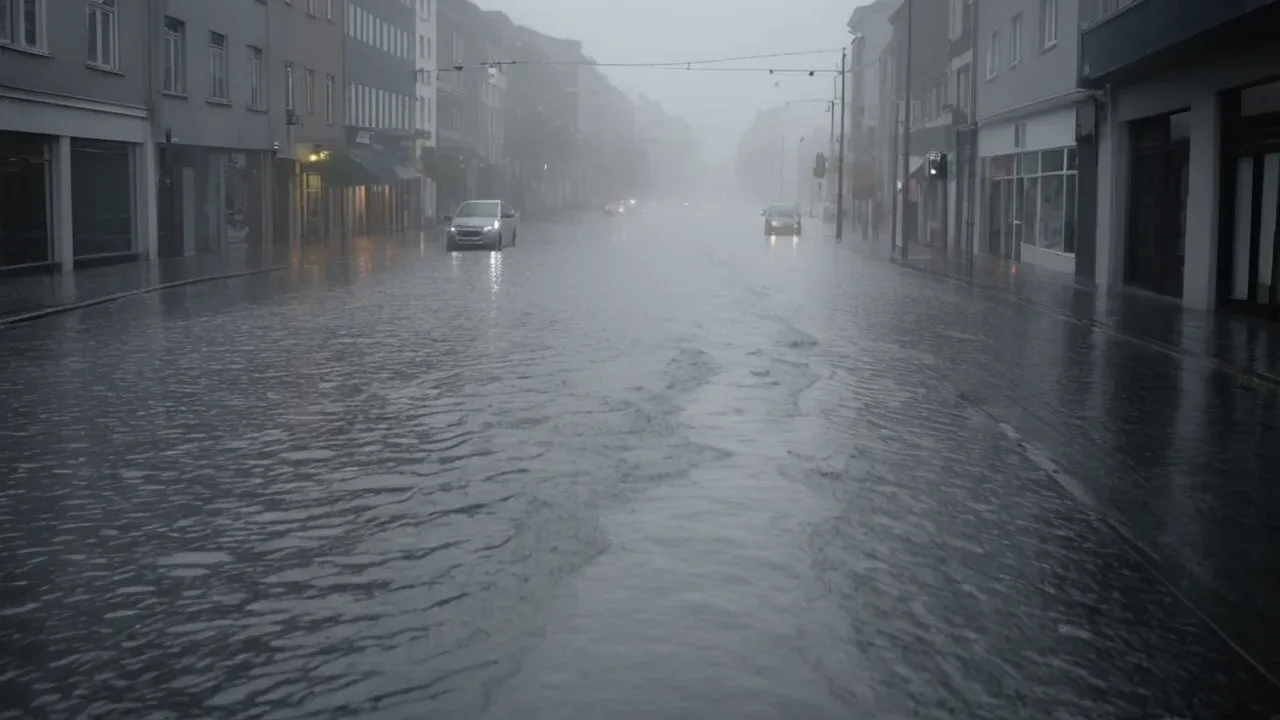
The rain didn’t just fall on Miami; it arrived with the weight of a physical presence, hammering the pavement in sheets that turned streets into rushing rivers. It was late October 2026, and the air hung heavy, saturated not just by humidity but by the invisible, expanding breath of a Pacific Ocean that had grown too hot to hold its secrets. This was not a storm arriving from nowhere. It was the exhale of a phenomenon that had been building in the deep waters for months, a "super" El Niño that scientists were watching with a mix of awe and dread as it reshaped the weather map of the world [1]phys.orgAs cities prepare for 2026's super El Niño, some crucial blind spots can't be ignoredThis year's El Niño has the potential to be one of the strongest in living memory, and the evidence is showing up around the world.Open source ↗.
We are no longer observing a cycle. We are witnessing a collision. The 2026 El Niño represents a convergence of historical precedent and unprecedented environmental conditions that challenge existing predictive models, necessitating immediate reevaluation of global preparedness strategies because current frameworks cannot fully account for the synergy between background warming and this specific oscillation type [4]gizmodo.comScientists Warn This Year’s El Niño Could Create Brand New Extreme Weather PatternsSynergy between global warming and a type of El Niño not seen since the late 1990s could create unprecedented weather that scientists don’t have enough climate data to model.Open source ↗[1]phys.orgAs cities prepare for 2026's super El Niño, some crucial blind spots can't be ignoredThis year's El Niño has the potential to be one of the strongest in living memory, and the evidence is showing up around the world.Open source ↗. This event is not another cycle in the long-standing interaction between the Pacific Ocean and the atmosphere; it is a distinct phenomenon driven by record-breaking physical mechanisms that signal a shift in how extreme climate events behave under modern conditions. As cities prepare for the winter of 2026, the evidence suggests that this event could rank among the strongest in living memory, requiring a fundamental shift from passive observation to active, data-driven adaptation [1]phys.orgAs cities prepare for 2026's super El Niño, some crucial blind spots can't be ignoredThis year's El Niño has the potential to be one of the strongest in living memory, and the evidence is showing up around the world.Open source ↗.
The Mechanics of a Super Event
To understand the magnitude of the current crisis, one must examine the physical drivers fueling the El Niño, which are currently operating with unprecedented intensity. Record Pacific wind anomalies are acting as the primary engine for this event, pushing warm water eastward across the tropical Pacific basin [2]severe-weather.euThe 2026 Super El Niño is Breaking Records, With Winter 2026/2027 Weather Impacts AheadRecord Pacific wind anomalies are fueling Super El Niño 2026, with new Winter 2026/2027 forecasts showing shifting temperature, precipitation, and snowfall patterns across the United States, Canada, a ...Open source ↗. These winds strip heat from the western Pacific and deposit it into the eastern basin, creating subsurface heat reservoirs that drive the continued strengthening of the thermal anomaly [2]severe-weather.euThe 2026 Super El Niño is Breaking Records, With Winter 2026/2027 Weather Impacts AheadRecord Pacific wind anomalies are fueling Super El Niño 2026, with new Winter 2026/2027 forecasts showing shifting temperature, precipitation, and snowfall patterns across the United States, Canada, a ...Open source ↗. This mechanism is critical because it indicates that the event is not just a surface phenomenon but is rooted in deep oceanic heat content, allowing it to persist and intensify with greater momentum than typical events.
The intensity of this event has already crossed significant scientific thresholds. The 2026 event has been confirmed as very strong, with sea surface temperatures reaching levels that correspond to a +2.6 degrees Celsius anomaly relative to baseline averages [3]msn.comEl Niño 2026 confirmed very strong: NOAA strips climate change from measurementEl Nino 2026 has crossed the very-strong threshold at +2.6 degrees C -- but NOAA's new Relative Oceanic Nino Index, which strips background climate warming from the reading, still puts this event ...Open source ↗. However, NOAA has introduced a new metric called the Relative Oceanic Niño Index, which strips background climate warming from the reading to isolate the natural oscillation component [3]msn.comEl Niño 2026 confirmed very strong: NOAA strips climate change from measurementEl Nino 2026 has crossed the very-strong threshold at +2.6 degrees C -- but NOAA's new Relative Oceanic Nino Index, which strips background climate warming from the reading, still puts this event ...Open source ↗. Even after removing the influence of global warming, the event remains exceptionally strong, indicating that the underlying dynamics are powerful independent of the broader climatic trend. This distinction is vital for scientists trying to disentangle the effects of long-term climate change from the immediate impacts of the El Niño cycle itself.
Forecasters warn that this climate pattern could reach exceptional intensity and influence weather through the winter and into 2027 [6]msn.comHow three Super El Niño forecasts compareForecasters warned the climate pattern could reach exceptional intensity and influence weather through the winter and into 2027.Open source ↗. The current status indicates that El Niño conditions are firmly established in the tropical Pacific and are expected to intensify through the end of 2026. There is an 81 percent chance of a very strong El Niño developing during October through December, with peak intensity likely arriving in late fall or early winter. This timeline suggests that the most severe impacts will coincide with the traditional peak season for weather-related disasters, compounding the risks for vulnerable populations.
Compass Predictive Analytics

Predictive Models and Scientific Uncertainty
The uncertainty surrounding the 2026 El Niño is not due to a lack of data collection but rather a fundamental gap in how we model the interaction between oceanic heat and atmospheric circulation under warming conditions. The synergy between global warming and this specific type of El Niño, which has not been observed since the late 1990s, is creating brand new extreme weather patterns that scientists lack sufficient climate data to predict accurately [4]gizmodo.comScientists Warn This Year’s El Niño Could Create Brand New Extreme Weather PatternsSynergy between global warming and a type of El Niño not seen since the late 1990s could create unprecedented weather that scientists don’t have enough climate data to model.Open source ↗. This is the core reason for the heightened worry among experts; historical records provide a template for what El Niño looks like, but they do not provide a reliable forecast for how it will behave when superimposed on a warmer planet.
NOAA's Geophysical Fluid Dynamics Laboratory experimental SPEAR forecast ensemble projects all 30 members reaching a strength competitive with the strongest events observed over the past century. This consensus among models suggests that the event is not an outlier in terms of intensity but is part of a broader trend toward more extreme oscillations. However, the persistence of this event adds another layer of complexity. NOAA estimates a 97 percent chance the event will persist into early spring 2027. Such prolonged duration can lead to cumulative impacts on ecosystems, agriculture, and infrastructure that are difficult to manage in real-time.
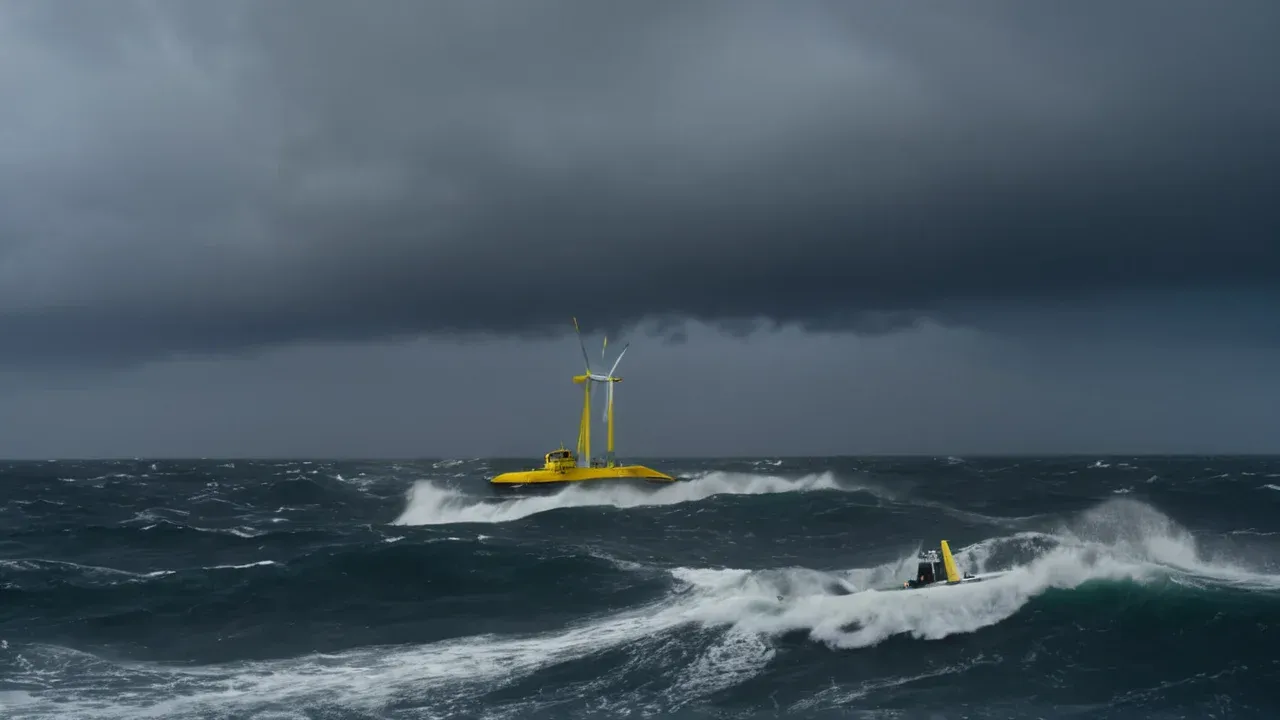
The scientific response to this uncertainty has been swift and targeted. Researchers are scrambling to answer fundamental questions about how El Niño forms under these new conditions [7]usatoday.comEl Niño update says it's still strengthening as researchers scrambleAn unprecedented El Niño sends scientists scrambling for answers Scientists hope a fleet of Saildrones will help answer questions about how El Nino forms before the next major climate event.Open source ↗. A fleet of Saildrones is being deployed to gather data before the next major climate event, highlighting a critical gap in our observational capabilities [7]usatoday.comEl Niño update says it's still strengthening as researchers scrambleAn unprecedented El Niño sends scientists scrambling for answers Scientists hope a fleet of Saildrones will help answer questions about how El Nino forms before the next major climate event.Open source ↗. These autonomous vessels will provide high-resolution data on sea surface temperature, salinity, and wind stress, filling in gaps that traditional satellite and buoy networks may miss. This effort underscores the realization that as events become more extreme, current observational tools may be insufficient for real-time modeling [7]usatoday.comEl Niño update says it's still strengthening as researchers scrambleAn unprecedented El Niño sends scientists scrambling for answers Scientists hope a fleet of Saildrones will help answer questions about how El Nino forms before the next major climate event.Open source ↗. The goal is to improve our understanding of the physical mechanisms driving the event so that future forecasts can be more accurate and actionable.
Compass Predictive Analytics

Projected Weather Impacts Across the United States
The impacts of the 2026 Super El Niño are expected to be widespread, with significant variations across different regions of the United States. The event is forecast to shift winter temperature, precipitation, and snowfall patterns in ways that differ from historical norms [2]severe-weather.euThe 2026 Super El Niño is Breaking Records, With Winter 2026/2027 Weather Impacts AheadRecord Pacific wind anomalies are fueling Super El Niño 2026, with new Winter 2026/2027 forecasts showing shifting temperature, precipitation, and snowfall patterns across the United States, Canada, a ...Open source ↗. These shifts are not uniform; they create a complex mosaic of risks that vary by geography and local infrastructure resilience.
California faces the most immediate threat from heavy rainfall and potential flooding. The influx of moisture from the eastern Pacific is expected to bring significant precipitation to the state, which could be beneficial for drought recovery but dangerous if it falls in short, intense bursts [2]severe-weather.euThe 2026 Super El Niño is Breaking Records, With Winter 2026/2027 Weather Impacts AheadRecord Pacific wind anomalies are fueling Super El Niño 2026, with new Winter 2026/2027 forecasts showing shifting temperature, precipitation, and snowfall patterns across the United States, Canada, a ...Open source ↗. Additionally, the Sierra Nevada mountain range is expected to receive heavy snowfall, which could impact water storage and ski industry operations. While increased snowpack is generally positive for long-term water resources, the rapid melting associated with warmer temperatures can lead to flash flooding and mudslides, particularly in areas that have been burned by recent wildfires.
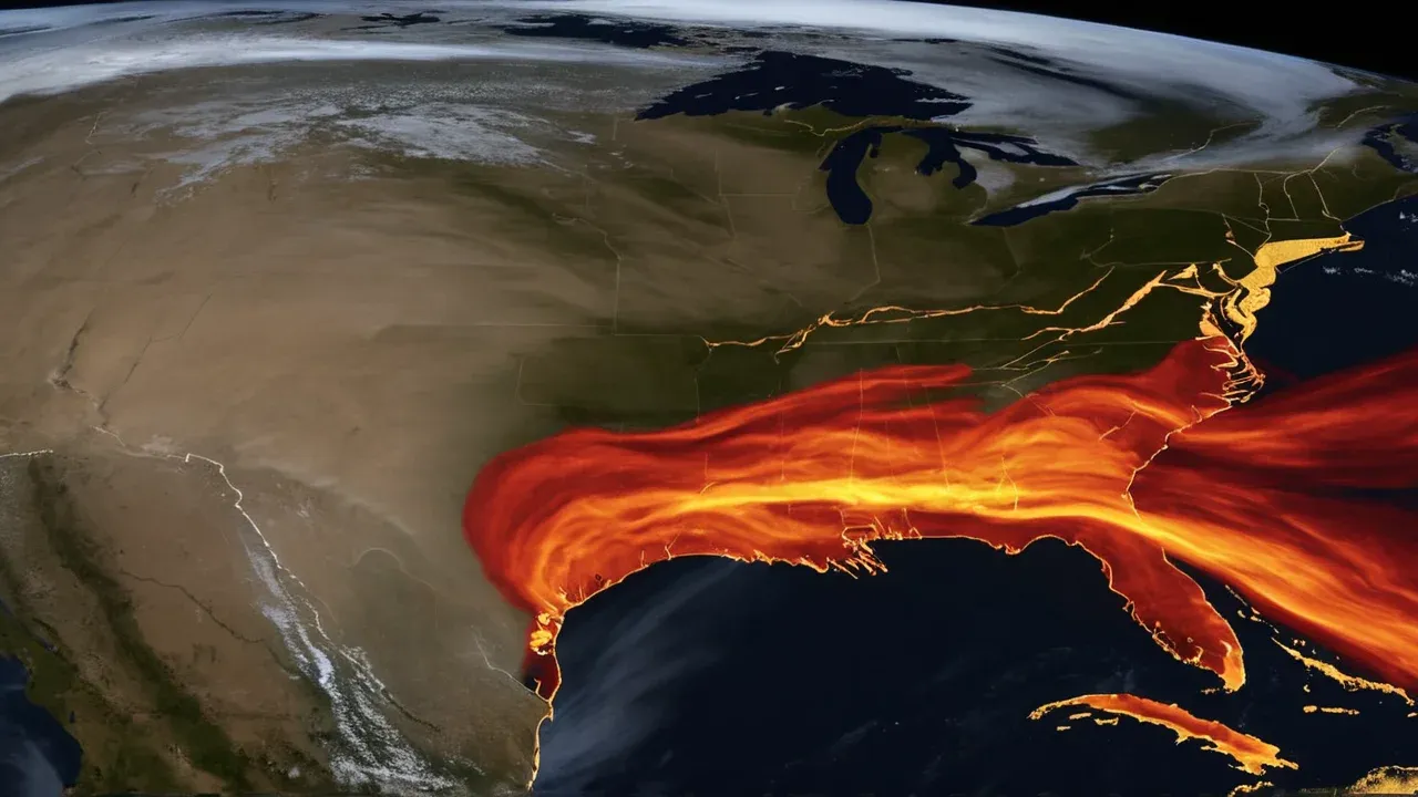
The Gulf Coast and Southeastern states are also at risk, though from a different set of hazards. Heavy rainfall and increased severe weather are forecast for this region [2]severe-weather.euThe 2026 Super El Niño is Breaking Records, With Winter 2026/2027 Weather Impacts AheadRecord Pacific wind anomalies are fueling Super El Niño 2026, with new Winter 2026/2027 forecasts showing shifting temperature, precipitation, and snowfall patterns across the United States, Canada, a ...Open source ↗. The warm waters of the Gulf of Mexico can fuel tropical systems, leading to more frequent and intense storms. This poses a significant threat to coastal communities that are already vulnerable to sea-level rise and hurricane damage. The combination of high winds and heavy rain can lead to widespread power outages and infrastructure damage, straining emergency response resources.
Florida is expected to experience severe storms and tornadoes as the El Niño shifts jet stream patterns [2]severe-weather.euThe 2026 Super El Niño is Breaking Records, With Winter 2026/2027 Weather Impacts AheadRecord Pacific wind anomalies are fueling Super El Niño 2026, with new Winter 2026/2027 forecasts showing shifting temperature, precipitation, and snowfall patterns across the United States, Canada, a ...Open source ↗. The state’s low-lying geography makes it particularly susceptible to storm surge and flooding. Tornado outbreaks are often associated with the transition periods of El Niño events, when atmospheric instability increases. This creates a dual threat for Floridians: coastal flooding from tropical systems and inland damage from severe thunderstorms. These impacts highlight the need for region-specific preparedness strategies that account for the unique vulnerabilities of each area.
Compass Predictive Analytics
The Broader Implications for Climate Science
The 2026 El Niño serves as a critical test case for climate science, forcing researchers to confront the limitations of their models and the inadequacy of historical data in predicting future extremes. The primary worry stems from the combination of a 'super' intensity event and the lack of modern historical data to model its specific impacts due to the unique synergy with background climate warming [8]youtube.comWhy El Niño 2026 has scientists worried | The Global StoryWhy El Niño 2026 has scientists worried | The Global StoryOpen source ↗. This affects policymakers, insurance companies, and global health organizations who must plan for scenarios that exceed current risk assessments.
The potential for this event to be one of the strongest in living memory means that we are entering uncharted territory in terms of human experience. While historical records go back centuries, they do not capture the current state of the planet, which is warmer and more humid than in previous eras. This makes it difficult to draw direct parallels between past events and current predictions. The evidence is showing up around the world, from altered rainfall patterns in South America to drought conditions in Southeast Asia [1]phys.orgAs cities prepare for 2026's super El Niño, some crucial blind spots can't be ignoredThis year's El Niño has the potential to be one of the strongest in living memory, and the evidence is showing up around the world.Open source ↗. These global impacts underscore the interconnectedness of the climate system and the far-reaching consequences of a single oceanic phenomenon.
As forecasters warn that this event could evolve into a rare "super" El Niño and potentially rank among the strongest events on record, the scientific community is urged to prioritize research and adaptation [5]newsweek.comSuper El Niño Threat Grows: Map Shows At-Risk States This WinterA developing El Niño climate pattern is forecast to strengthen significantly during the second half of 2026, with some forecasters warning it could evolve into a rare "super" El Niño and potentially rank among the strongest events on…Open source ↗. The deployment of new technologies like Saildrones is a step in the right direction, but it is not enough. We need a fundamental shift in how we approach climate modeling, incorporating real-time data and dynamic feedback loops that account for the changing baseline of global temperatures. The 2026 El Niño is a warning shot, signaling that the era of predictable climate cycles may be over.
The worry among scientists regarding the 2026 El Niño is well-founded. It is not about the intensity of the event but about the unprecedented nature of its interaction with global warming. The synergy between these two factors creates a scenario that is difficult to model and even harder to prepare for. The projected impacts across the United States, from California to Florida, highlight the diverse and severe risks involved. As we move through the winter of 2026 and into 2027, the persistence of this event will test our resilience and adaptability. The scientific community must remain vigilant, continuing to gather data and refine models to better understand and mitigate the impacts of future extreme climate events. The time for passive observation is over; active engagement and innovation are required to navigate the challenges ahead.